Schneifel, Germany: Restoration implementation underway
In the Schneifel case study area, which is one of the seven case study sites in the SpongeBoost project, restoration activities have recently moved into implementation. The measures are being coordinated by Stiftung Natur und Umwelt Rheinland-Pfalz (SNU) together with Forstamt Prüm under the state peatland conservation programme. The aim is to restore a more natural water regime in two sub-areas, at Klöckersfenn and above Rohrvenn, by closing existing drainage ditches and reducing the hydrological impacts of past drainage and forestry use. At the same time, large parts of the spruce stands are being removed using cable-crane technology in order to minimise soil disturbance and support the long-term development of site-typical wet forest habitats such as alder and birch. Positive effects are also expected for the adjacent fens and wet heath areas within the catchment.
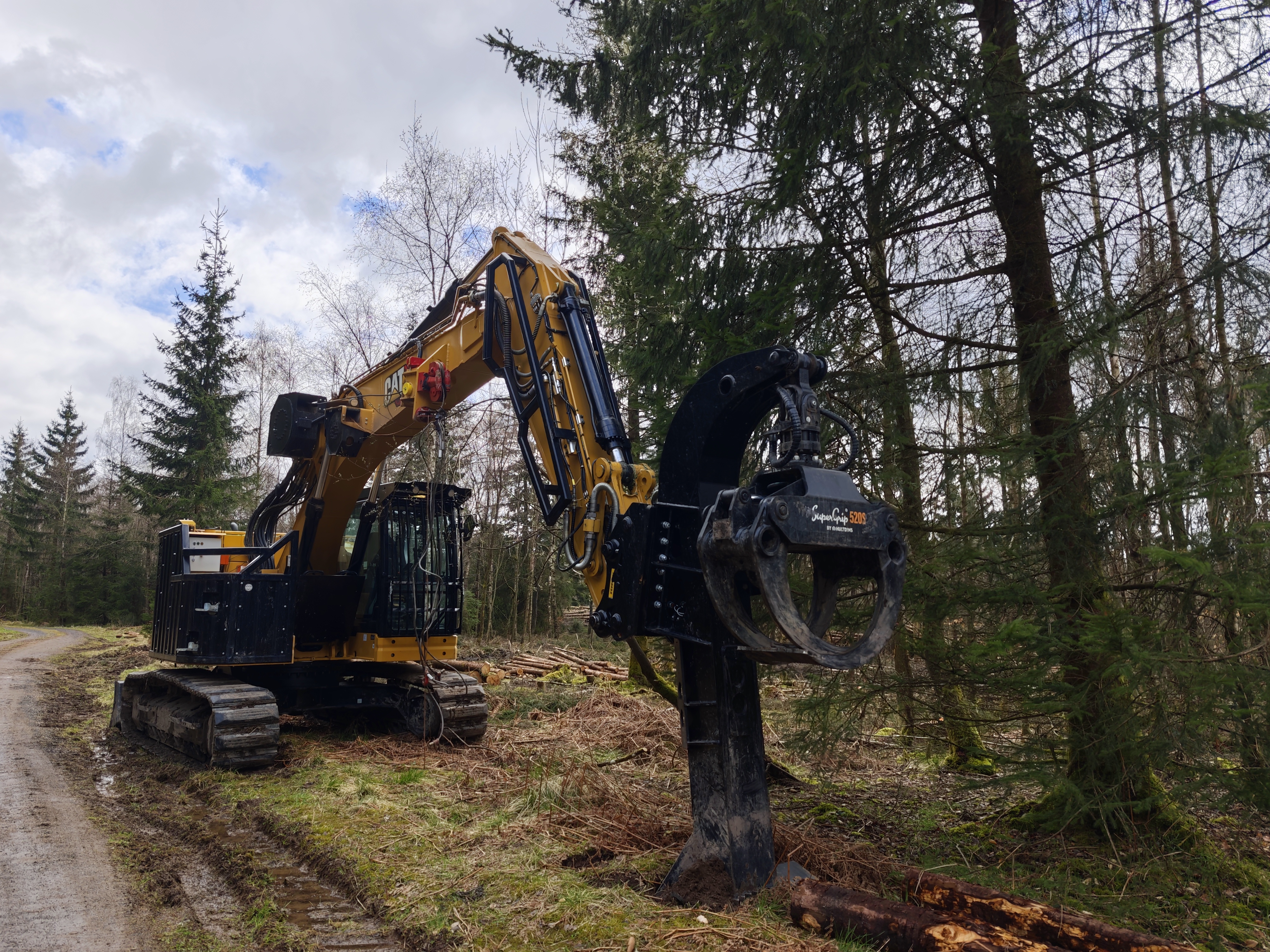
Spruce removal using low-impact cable-crane technology in the Schneifel restoration area
A major recent highlight is that the cable-crane operation has started, and the spruce removal in one of the project areas has already been completed. The next step will be the closure of drainage ditches, which is expected to begin soon. In total, around 150 small retention structures are planned in the ditch system in order to raise water levels, slow drainage, and redirect water back into the surrounding peatland areas. The implementation is being carried out by a specialised contractor experienced in peatland restoration under demanding site conditions. In parallel, vegetation monitoring on permanent plots is already in place to document ecological changes over time.
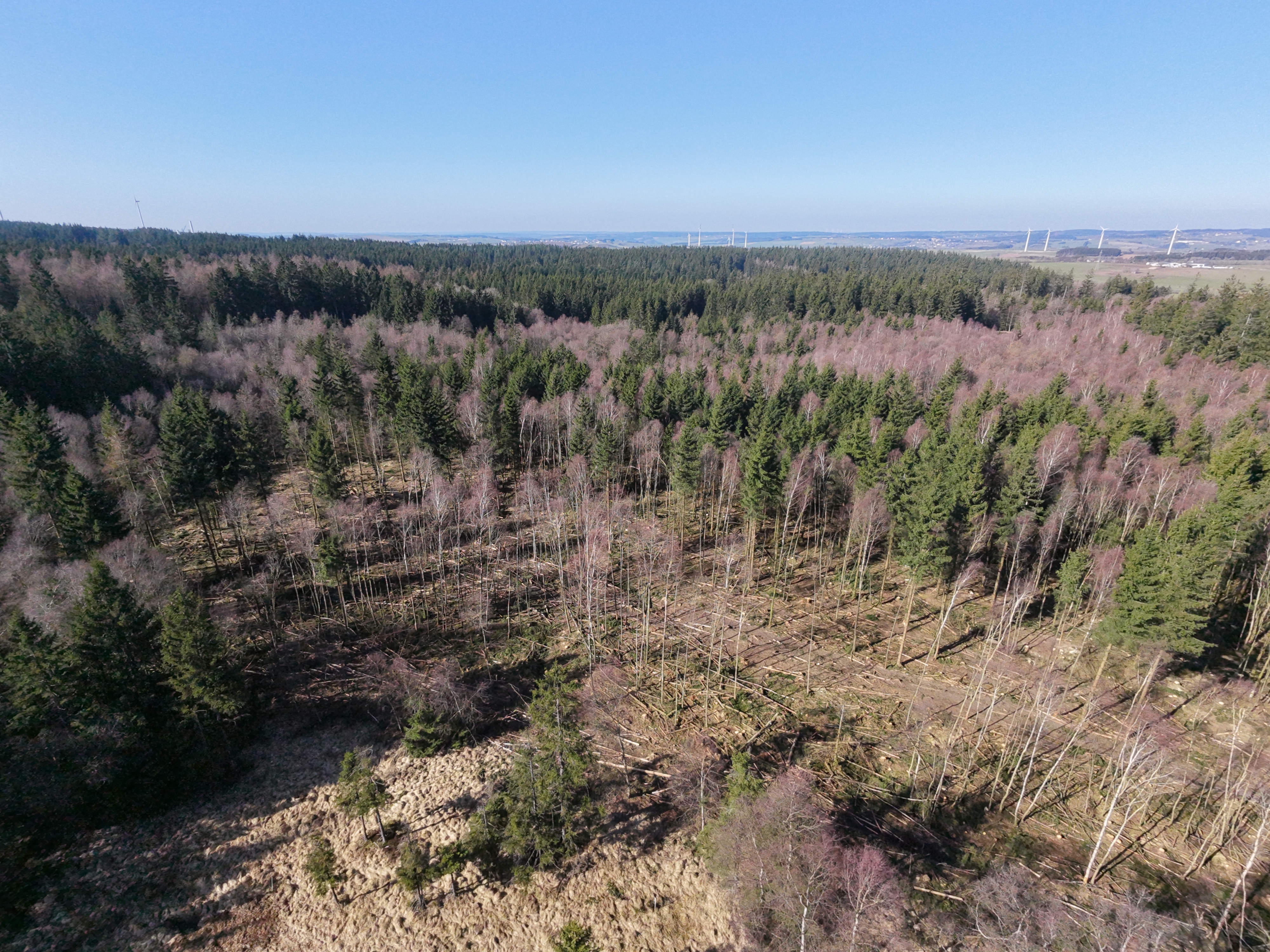
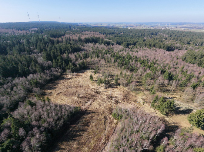
Areas where spruce forests have been removed
From the SpongeBoost research perspective, RWTH Aachen University is focusing on hydrological monitoring and modelling to quantify restoration effects on water retention and runoff dynamics. Since February 2026, hydrological monitoring at the catchment outlet has been operating continuously, recording water level and flow velocity. A data-processing workflow has been established to combine these observations with nearby German Weather Service data and convert the raw measurements into discharge plots and time series for hydrological modelling. Initial model setup and first calibration steps will start soon. In addition, further monitoring is being prepared: a triplet design with soil moisture and temperature sensors is planned to compare the soil conditions of near-natural, degraded, and rehabilitated sites, and to support future model parameterisation and scenario analysis.
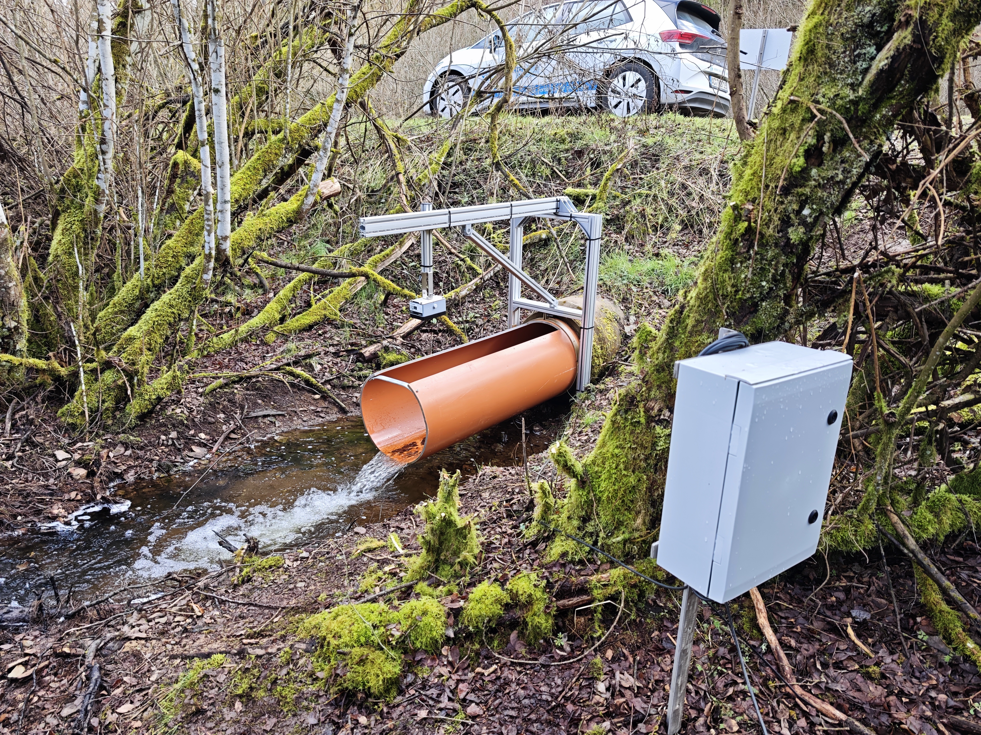
Hydrological monitoring station at the catchment outlet, recording water level and flow velocity for restoration assessment
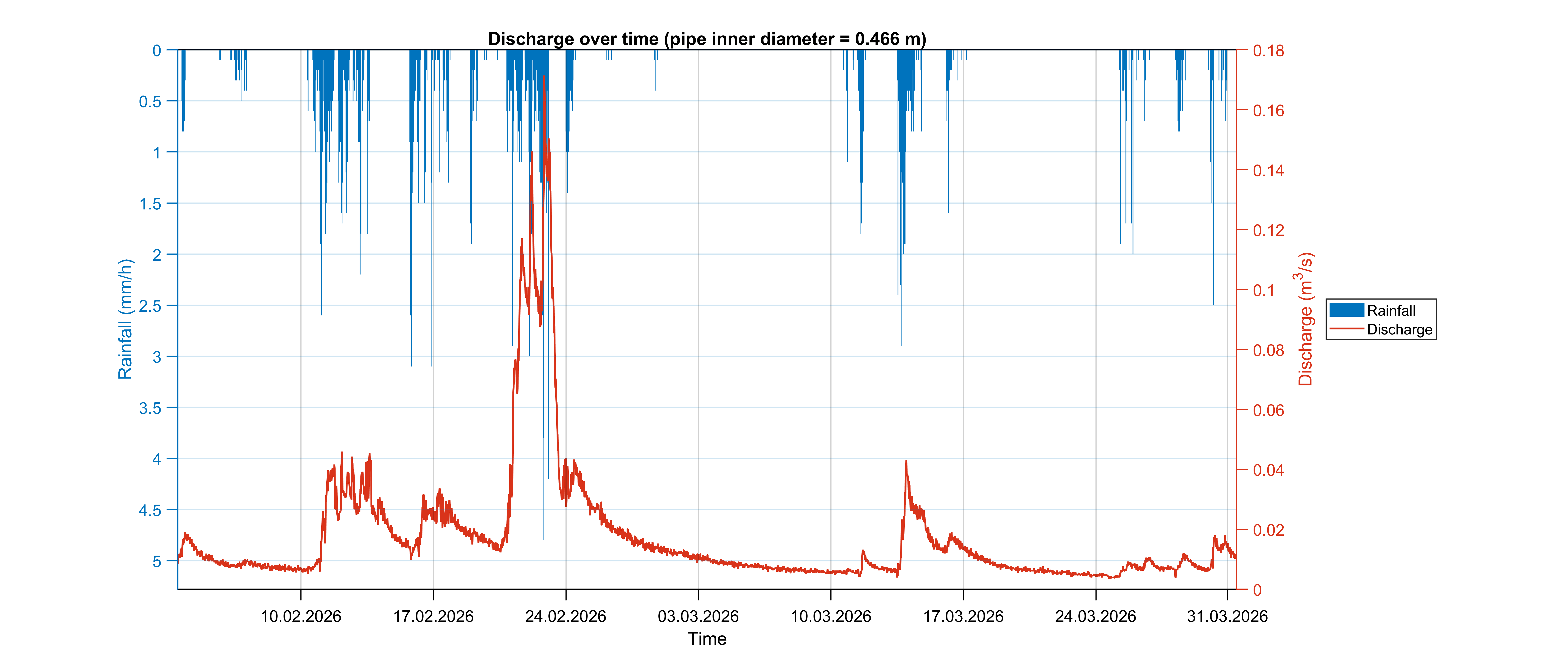
First continuous hydrological monitoring data from the Schneifel study area, used for model development and calibration